Xplorer Maps
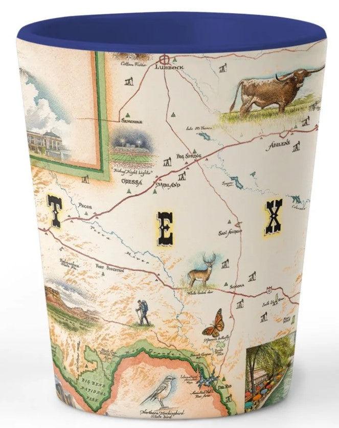
Ceramic Shot Glass - Texas State Map
Ceramic Shot Glass - Texas State Map
Couldn't load pickup availability
The Xplorer Maps Shot Glasses are designed around the exquisite map art by Xplorer Maps co-founder and illustrator Chris Robitaille. These ceramic, BPA-Free shot glasses are designed in the USA and printed with crystal clear graphics. These are perfect gifts for national park lovers, map connoisseurs and anyone who’s ever visited these incredible places.
- 1.5 oz. Capacity
- High Quality Ceramic Construction
- Superior, High-Quality Graphics
- BPA-Free
- 2.5" tall and 2.5" in diameter
- Hand-wash only
- Due to high quality graphics, dishwasher and microwave use is NOT recommended
Texas is located on the southern boundary of the United States and due to its size and location, it shares borders with Louisiana, Arkansas, Oklahoma and New Mexico, as well as two Mexican states and the Atlantic Ocean on the Gulf of Mexico. The four major physical regions found within Texas are the Great Plains, the Interior Lowlands, the Coast Plains as well as the Basin and Range Province. The Basin and Range Province is shown in the southwest corner of the state in which the south and western boundary of the state are determined by the path of the Rio Grande as it flows south to the Gulf of Mexico. This region is home to the major city of El Paso, tucked in the westernmost corner of the state. Within the Great Plains region of Texas to the north of the state, the map highlights the major cities of Amarillow and Lubbock with the significant landmarks of Cadillac Ranch and cotton fields near Lubbock. In the Interior Lowland region to the east are the major cities of Dallas, Irving and Fort Worth. Further south are the major cities of Austin (state capital as well as live music capital of the world), and San Antonio (famous for its riverwalk, Tower of the America’s as well as being the location of the famous Spanish mission, the Alamo). In the Gulf Coastal Plains region, only miles from the shore of the Gulf of Mexico are cities such as Houston, Galveston, and Corpus Christie.
Along with the urban areas and their cultural attractions, the physical landscape of Texas features a variety of national parks and landmarks. These include Guadalupe Mountains National Park west central Texas, Big Bend National Park in southwest Texas, Rita Blanca National Grasslands, as well as Davy Crockett National Forest, Sam Houston National Forest, and Angelina National Forest in the eastern region of Texas. The physical features and the vast space found within these open plains areas as well as an abundance of water supply near the coast has made Texas a perfect environment for farming and ranching. The success of agriculture in the state has created a southwest/western culture based around ranching, rodeo, and cowboy culture celebrated with an illustration of a Texas Longhorn bull in the heart of the map.
The climate of the plains and coastal plains region creates an environment well-suited for a variety of plants, animals, and insects such as: Altamira Orioles, green jays, buff-bellied hummingbirds, Great Kiskadee, nine-banded armadillos, Guadalupe bass, venus flytraps, feral hogs, white-tailed deer, as well as marine life on the coast such as bottle-nose dolphins and Kemp’s ridley sea turtles.